Hazard Mitigation Planning Hazard mitigation planning is an important aspect of a successful mitigation program. States and communities use the hazard mitigation planning process to set short and long-range mitigation goals and objectives. Hazard mitigation planning is a collaborative process whereby hazards affecting the community are identified, vulnerability to the hazards are assessed, and consensus reached on how to minimize or eliminate the effects of these hazards. In recognition of the importance of planning, States with an approved enhanced State Mitigation Plan in effect at the time of disaster declaration may receive additional HMGP funding. The Hazard Mitigation Grant Program is authorized under Section 404 of the Robert T. Stafford Disaster Relief and Emergency Assistance Act. Geographical Information Systems (GIS) At Flanagan & Associates, LLC we apply geo-spatial mapping techniques to generate valuable analysis and informative statistics illustrated by maps, tables and qualitative remarks to many aspects in our current hazard mitigation and floodplain projects. Disaster preparedness at the planning level involves identifying man-made and natural hazards capable of impacting the community or business, assessing the vulnerabilities to those hazards and lessening the capacity (mitigation) for those hazards to impact the infrastructure, ecosystems and public safety. Map Data includes: Public Data: watersheds, rivers, contours 10 meters, aerial photos, TIGER files (roads, highways), Proprietary & Government Data: Flood & Tornado Warning sirens, assessor parcel boundaries, AutoCAD building footprints, contours 2’, repetitive loss floodplain properties, historic flood boundaries (paper only), tornado events (NCDC), urban building footprints, regulatory floodplains, sewer lift stations, Rural Fire Department coverage areas, river elevation section lines, dam inundation maps, Floodplain Management A community's agreement to adopt and enforce floodplain management ordinances, particularly with respect to new construction, is an important element in making flood insurance available to home and businesses owners. Over 20,000 communities voluntarily adopt and enforce local floodplain management ordinances providing flood loss reduction building standards for new and existing development. In an effort to encourage communities to establish sound floodplain management programs that go beyond the National Flood Insurance Program (NFIP) minimum requirements the Community Rating System (CRS) was created. Under the CRS flood insurance premium rates are adjusted to reflect the reduced flood risk resulting from community activities.
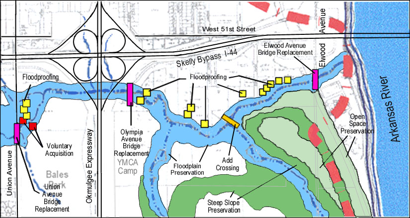
Stream Corridor and Greenway Planning
National Flood Insurance ProgramFlanagan & Associates, LLC has long been extensively involved with Tulsa’s floodplain management efforts. Flanagan was an early (1973) consultant to several homeowners’ associations, and in 1976 was planning consultant for Vensel Creek, Tulsa’s first basin-wide master drainage plan (MDP). Mr. Flanagan has served as floodplain management consultant to the City of Tulsa, more or less regularly, since 1976. He works regularly with the Oklahoma Water Resources Board (OWRB) and the state NFIP coordinator, is a past-chair of the Oklahoma Floodplain Managers Association (OFMA), is the Editor of the "B.F.E." (the OFMA monthly newsletter) and is a Certified Floodplain Manager (CFM). The Mitigation Division at FEMA is the organization responsible for working with communities to encourage them to adopt and enforce ordinances that meet or exceed the minimum floodplain management requirements of National Flood Insurance Program. Floodplain and Repetitive Loss NotificationOn a continuing basis services have included:
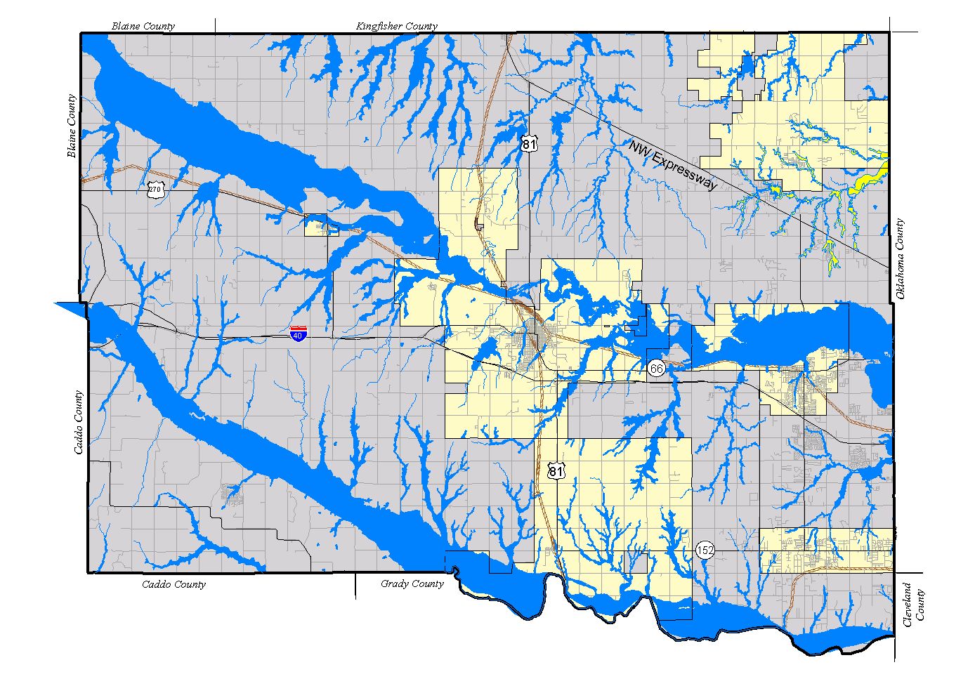
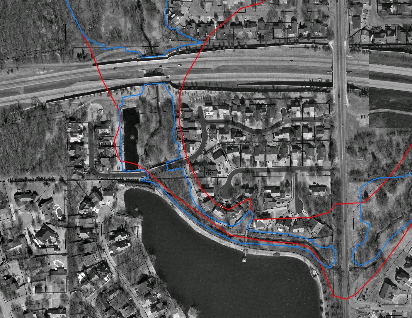
Flanagan & Associates, LLC maintains a floodplain database of the addresses and location, by drainage basin, of 2,637 buildings located in the FEMA Special Flood Hazard Area, and 6,065 buildings located in the City of Tulsa’s Regulatory Floodplain. The firm maintains 1"=200’ land-use base maps of the FEMA and Regulatory floodplains, and addresses of all buildings located therein, and properties touched by the floodplain. |